Traffic Center Germany (VZD)
Development of basic data and telematics platform for the VZD
Within the framework of the E21X project, initiated by Hessen Mobil, the basis for the former Traffic Center Hessen (VZH) was created. When Die Autobahn GmbH des Bundes took over the tasks of managing the highways, the VZH became the Traffic Center Germany (VZD).
The VZD is a central system of German traffic management. In the future, it is to take over the coordination of all German traffic centers. At the same time, the VZD also fulfilled the functions of the traffic control center for the western branch of the Autobahn GmbH. As part of the E21X project, Heusch/Boesefeldt created the basic data and telematics platform lots.
The Basic Data lot includes all functionalities for cross-segment traffic-related configuration and for the use and maintenance of geodata.
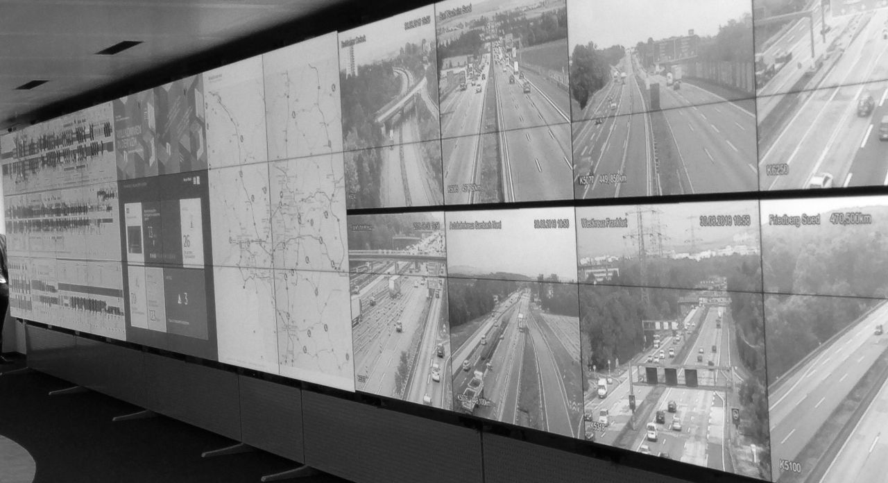
The VDZ system, meanwhile renamed AutobahnOS by Autobahn GmbH, is based on a service-oriented architecture in which all modules of the individual segments are integrated. Key functions of the VZD integration platform, such as the configuration service and user management with Keylcloak, are also used by the telematics platform created by HB. The telematics platform handles TLS communication with the infrastructure and measurement value processing in accordance with MARZ 2018. The configuration service, which—very importantly—has version management, is used here to manage the TLS configurations of the TLS infrastucture and video cameras. It is designed so that it can manage any future configurations. The geoservice manages the geographic map based on an OpenStreetMap (OSM) and the location code list (LCL) and kilometerization of the relevant roads. The various geo-references are mapped onto each other in the geo-service. The geo-service also includes version management.
For a more simplified, clear representation of the superordinate road network, a user-editable schematic map has been implemented.
For the data distribution the functions of the Kafka of the AutobanOS basic functions are used.
All user interfaces, including map displays and editors, have been implemented as web GUIs. Automatic updating of the display of dynamic data is ensured.